The hiking trail par excellence in Extremadura is the Via de la Plata, the southern St. James Way, also called silver way. It stretches across the region from the south to the north and through the towns Zafra, Merida, Caceres and Baños de Montemayor. A large part of the Via de la Plata ranges along the ancient Roman trade route and at many sections even on it. The southern St. James Way is excellently signposted. Alongside this road there are dozens of small, welcoming pubs and bodegas for stopping and resting. The descriptions of the trail sections in plenty of hiking guides are so good that you will not need to inform yourself in advance of starting the journey. The pilgrimage way is recommended not only to experienced hikers, but also to tourists who want to travel by foot one day or one weekend. On the way you will meet people from all over the world who are walking to the Basilica of Santiago de Compostela. Many pilgrims love telling about the walk and their experiences.
Anyone interested in the richness of species in Extremadura will do better to participate in a guided tour within the national park of Monfragüe. Daily tours through the forests of the park and to ornithology stations are organised in Villarreal de San Carlos.
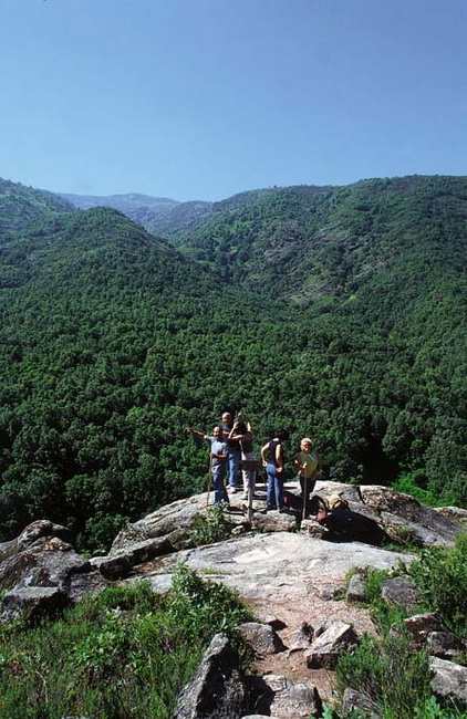
One of the most beautiful regions for hiking and cycling are the valleys in northern Extremadura. It is now possible to book guided tours with British travel agencies. Tourists can also easily rent bicycles in the region and get maps on the spot. A varying trail section leads from the small village Jerte to the cherry valley that offers a breathtaking spectacle at its hillsides, especially when the flower is in full bloom in March and April. After a while there is the nearby Valle del Jerte, through which the Garganta de los Infernos flows. The way goes through a great deal of old oak trees, between which ferns, heathers and lavender are growing. Lizards and psammodromus rest on tree branches. The more you approach the mountain runnel, the more dippers you see flying through the air. It is also possible to behold the shy and rare grey wagtails there. You leave the course of the Garganta de los Infiernos only at the end of the six hour hike, ending in Jerte.
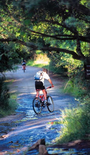
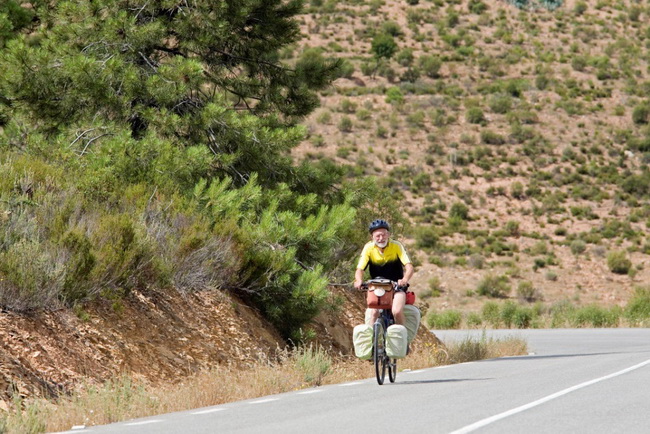
There are likewise cycling trails leading through the Jerte valley and the neighbouring valleys Ambroz and Vera. Anyone who is travelling by mountain bike and is fit enough can cross the three valleys from the west to the east. A winding road leads uphill from the first valley, Valle de Ambroz, to the small village Cabazebellosa at an altitude of roughly 1,000 metres. Cyclists go up to 1,270 metres in Garganta la Olla, which is situated on a hill between the Ambroz and the cherry valley. From there on, an asphalt road passes the monastery of Yuste to the most easterly of the three valleys: the Vera valley. Anyone who continues the way for a few kilometres will reach the river Tietar, where he can cool his feet. A popular destination for cyclists is also the artificial lake Gabriel y Galan, west of Plasencia, to which a nearly car-free road leads via Granadilla and Zarza de Granadilla along the Rio Alagon. The Cornalvo nature park east of Merida is also to be recommended to mountain bikers and hikers. The advantage of Cornalvo consists in the fact that it is only 10 kilometres away from the capital, and can therefore easily be got to by bicycle. Guided tours are organised to and within the nature park. The Cornalvo has diversified offers and different kinds of trail, from hiking ways to asphalted roads. Cyclists and hikers can inform themselves of the tours in the information centre of Trujillanos, located at the edge of the park. Mountain bikers also like to go through the Tierra Barros, which is located south of Merida. Cyclists can ride through the area as well as climb the 800 metre high Feria, near Villafranca de los Barros. Anyone who wants to visit the Dehesa and behold the Savannah countryside typical of Extremadura can drive in all four directions, because Extremadura is covered with oak trees everywhere. It is also possible to easily reach Sierra de San Pedros in the west, and the Sierra de Guadelupe in the east of Extremadura from Merida and Caceres. Small secondary roads with less traffic lead through both forest areas. The old A-road EX-214 proceeds westwards from Aljucen to Alburquerque through the beautiful and undulating Sierra de San Pedro. Climbers will particularly be fond of the Sierra de Guadalupe. Many cycling ways can be ridden on around the monastery of Guadalupe, which provide enough ascents and descents in a beautiful old forest area. An isolated asphalted road, beside which hundreds of storks and holly oaks are nesting, connects Logrosan and Madrigalejo in the vicinity of the monastery of Guadalupe. Before such a spectacle, even the most athletic cyclist and the most zealous hiker will stop and be impressed by the nature and its residents.
|